Product description
The Snow Surface Wetness (SSW) is a cutting-edge EO product designed to assess snow wetness conditions accurately over vast areas. It utilizes the Sentinel-3 SLSTR (Sea and Land Surface Temperature Radiometer), a part of the European Union's Copernicus programa, to detect and quantify snow surface wetness levels (categories of liquid water content in the snow surface - categorial).
Key features
- Advanced sensing technology: employs the Sentinel-3 SLSTR's advanced thermal and visible wavelength sensors to capture temperature and reflectance variations of the snow surface, indicative of different wetness levels.
- High spatial resolution: provides detailed imagery, enabling precise snow wetness analysis over diverse landscapes.
- Frequent revisits: the regular coverage by Sentinel-3 satellites ensures timely and updated information, essential for monitoring dynamic snow conditions.
- Temperature-based alysis: uses thermal data to distinguish between wet and dry snow, leveraging the thermal infrared channels of SLSTR.
- Reflectance characteristics: incorporates visible and near-infrared spectral data for enhanced wetness detection accuracy.
- Data integration: can be combined with other datasets like topographical and meteorological data for comprehensive snow condition analysis.
Limitations
- Cloud cover: the accuracy of SSW can be affected by cloud cover, as clouds obstruct the satellite’s view of the snow surface. This limitation can lead to gaps in data or the need for additional processing to mitigate the impact of cloud obstruction.
- Mixed pixel challenges: in regions where the snow cover is patchy or mixed with other land cover types, the resolution of the sensors might limit the ability to accurately determine wetness levels in mixed pixels.
Technical specifications
Links tot the interactive maps/data services
| Long name | Snow Surface Wetness (SSW) |
| Standard name | liquid_water_content_of_surface_snow [proxy*] *As there is no 'standard_name' attribute content for the SSW categorical variable in the CF Standard Name table, we have used the name for the liquid water content in snow as SSW is a proxy for this |
| Summary | The SSW product provides regular information on snow surface wetness categories (number of categories may vary) per grid cell for the given land area except for land ice areas. The product is based on optical satellite data, in particular from medium-resolution sensors. The algorithm requires full snow cover (with no tall vegetation extending over the snow surface). Areas with less than full snow cover are usually filled in with FSC based on coarse categories. Clouds are masked with the best available and applicable cloud-detection algorithm working over a snow-covered surface. |
| Instrument | Sentinel-3 Sea and Land Surface Temperature Radiometer (SLSTR) |
| Satellites | Sentinel-3A and Sentinel-3B |
| Units | Snow wetness categories |
| Spatial resolution | 500m |
| Temporal resolution | daily |
| Projection (Norway) | EPSG:32633 (UTM zone 33 / WGS 84) |
| Projection (Romania) | EPSG:32635 (UTM zone 35 / WGS 84) |
| Keywords | Snow surface wetness, earth observation, optical sensor |
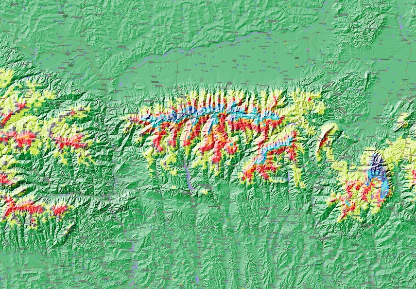
| Algorithm overview | The algorithm used for generation the wet snow product uses the Sentinel-3 SLSTR instrument to retrieve information about snow grain size and snow surface temperature. The temporal development of these variables is also used. Melting snow drives the optical, effective grain size up significantly. The amount of liquid water in the snow surface is related to this observed grain size. The temperature measurements assures that there cannot be other processes, in particular surface hoar, that create the measured large snow grain size. Based on this, the algorithm infers six snow wetness categories: Dry, cold snow Dry, moderate cold snow Dry, warming snow Moist snow Moist, warming snow Wet snow. |
| History | SnowLab processing chain v1.0 |
| Contact | Rune Solberg (snowlab@nr.no), Norwegian Computing Center |
SWW product is provided in two file formats: NetCDF and GeoTIFF/ Cloud Optimized GeoTIFF.
1. NetCDF
The attributes chosen are according to the recommendations given for NetCDF Conventions by UCAR/ CF Metadata Conventions and based on ACDD and GCMD standards.
| Global attribute | Content |
|---|---|
| title | SnowLab experimental product |
| institution | Norwegian Computing Center |
| instrument | <sensor> |
| platform | <satellite> |
| source | LN2 L1 RBT <creation date> O NT 004 |
| references | http://snowlab.nr.no |
| id | <filename without extension> |
| tracking_id | <unique product tracking identifier> |
| tile_identifiers | <list of filenames for original L-1B tiles without extension> |
| processing_level | Experimental or prototype product |
| format_version | SnowLab standards March 2021 |
| licence | Freely distributed, refer to SnowLab/EarthObs/NR |
| cdm_data_type | Byte |
| date_created | <YYYYMMDD>T<HHMMSS>Z |
| creator_name | Norwegian Computing Center |
| creator_url | https://www.nr.no |
| creator_email | snowlab@nr.no |
| project | SnowLab, Section for Earth Observation |
| geospatial_bounds | Upper left corner <easting>, <northing> Lower right corner <easting>, <northing> |
| geospatial_bounds_crs | EPSG:32633 |
| spatial_resolution | <product grid size> |
| time_coverage_start | <YYYYMMDD>T<HHMMSS>Z |
| time_coverage_end | <YYYYMMDD>T<HHMMSS>Z |
| time_coverage_duration | P1D |
| time_coverage_resolution | P1D |
| conventions | CF-1.8, ACDD-1.3 |
| naming authority | earthobs.nr.no |
| keywords_vocabulary | NASA Global Change Master Directory (GCMD) Science Keywords |
2. GeoTIFF
| Tag | Content |
|---|---|
| Driver | GTiff/GeoTIFF |
| Files | <filename> |
| Size | <grid xsize>, <grid ysize> |
| Coordinate System | <geographic coordinate system info> |
| Origin | <x_upper_left_corner>, <y_upper_left_corner> |
| Pixel Size | <xsize in coord. system units>, <ysize in coord. system units> |
| Metadata | <NetCDF attributes> |
| Image Structure Metadata | <image representation metadata> |
| Corner Coordinates | <corner coordinates in coordinate system> |
| Band 1 | <structure of band 1, including visualization> |
| Code | Category | Red | Green | Blue | Colour |
|---|---|---|---|---|---|
| 0 | Dry, cold snow | 255 | 255 | 255 | |
| 1 | Dry, moderate cold snow | 0 | 0 | 255 | |
| 2 | Dry, warming snow | 0 | 140 | 255 | |
| 3 | Moist snow | 255 | 140 | 0 | |
| 4 | Moist, warming snow | 255 | 255 | 0 | |
| 5 | Wet snow | 255 | 0 | 0 |
Data access
Open the map in the fully flaged application.
Custom products
Custom products can be created based based on user requirements.